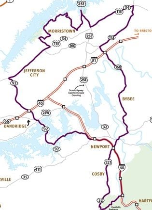
The lakes and waterways of the 9 Lakes Region of Tennessee were part of the first American Frontier. Discover the footprints of early explorers and pioneers on any of the trails. Driving, biking, hiking and paddling trails are all mapped for you!
Regional Motorcycle or Driving Trails
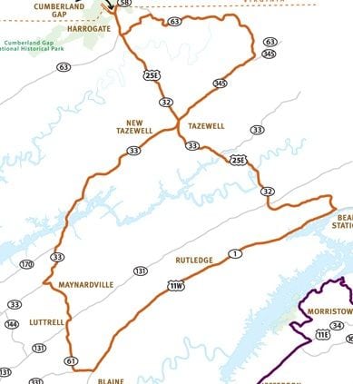
Blazing a Trail
The rolling farmlands and open roads of the valley make for a geographically interesting ride as you travel the road running parallel to the mountain ridges, clearly showing the necessity for a “gap” to get to the other side of the mountain.
126 miles/3 hours drive time
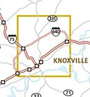
Urban to Wilderness
Since the 1780s, Knoxville has served as a hub for East Tennessee and the nation. Consequently it is rich in both history and natural beauty. While there are many scenic routes in the Knoxville area, this route focuses on the downtown.
20 miles/1 hour drive time
Hungry History Buff
Travel through time from a British Utopia to the atomic age. The ride is easy and the stops are plentiful. Each point along the trail depicts a moment in time where the landscape played a vital role in defining the culture of the region.
131 miles/3 hours drive time
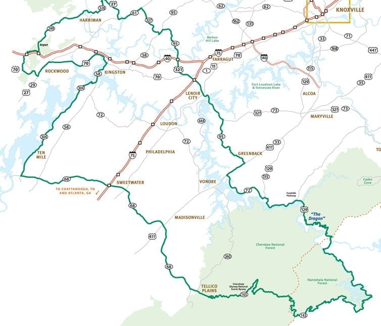
Mountain Survivor
Thrill-seekers will love the white-knuckle, curve-hugging, breath-taking switchbacks of this trail. It’s a challenging ride for skilled drivers that more than pays off with frequent scenic overlooks and changes in elevations from lake level to mountain top in a matter of a few minutes.
236 miles/7.5 hours drive time
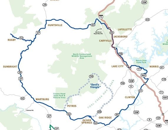
Still Water to White Water
Hugging the lake shoreline, this charming ride offers a nice balance of fairly easy to navigate mountain roads following the orginal Cherokee Warrior’s Path, across the Clinch Mountain, the Dixie Highway of the Civil War period and the Thunder Road of moonshine lore.
120 miles/3.5 hours drive time

A journey through the majestic Smoky Mountain peaks, rivers, caverns and rapids, the sky’s the limit on this trail. Explore Tuckaleechee Caverns or enjoy a live broadcast music performance at WDVX’s “Blue Plate Special,” at the Knoxville Visitor Center. Capture the adventurous spirit and try whitewater rafting on the Little Pigeon River.

Wind through Smoky Mountain backroads, lush Appalachian countryside. Jump-start your journey by shopping in Sevierville, hometown. See blacksmiths, carriage makers, potters, glassblowers at Gatlinburg’s Great Smoky Arts and Crafts Community. Stop at Newport/Cocke County Museum for Appalachian and Native American artifacts.

You’ll find some of the most picturesque panoramas America has to offer, with the Blue Ridge Mountains bordering the route on the east and the Tennessee River and its array of lakes to your west. The drive also includes five of the state’s most scenic rivers: Ocoee, Hiwassee, Tellico, Tennessee and Little Tennessee.

A trail of secrets to discover in the scenic Cumberland Plateau. Immerse yourself in Knoxville history by touring Blount Mansion, James White Fort and Bleak House, General Longstreet’s headquarters. Travel to the “Secret City” of Oak Ridge to visit the Manhattan Project National Historic Park and the American Museum of Science and Energy.

This trail is peppered with moonshine exhibits, Victorian Homes, Civil War sites, scenic overlooks, famous factories and post-production stock car speedways. There’s something worth seeing at every turn of the White Lightning Trail.

Experience mile-high vistas and brilliant season foliage as well as great hiking opportunities, vistas, and picnic spots in these magnificent portions of the Cherokee National Forest. The curvy 40+ two-lane road ranges in elevation changes from 900 feet to 5,400 feet. This is a favorite route for bicyclists.

Following the route of Daniel Boone’s Wilderness Road and the Great Indian Warpath, SR 25 East scenic byway winds through majestic mountain ridge vistas, along white-water rivers, hills and hollers, TVA lakes, farms, railroad towns, and artisan communities known for Appalachian crafts, quilting, and bluegrass music. This is the road to discover America.

Learn about “divided loyalties” in this self- guided trail tour through the towns, cities, farmlands, and cemeteries of East Tennessee, part of the Tennessee Civil War National Heritage Area. East Tennessee geographic position lent itself to some of the largest campaigns between the North and South, leading to families split between fighting for the Confederates or the Union.

This National Scenic Foot Path crosses through 71 miles of Tennessee including portions of the Smoky Mountain National Park and Cherokee National Forest. The small historic town of Newport, located along the Pigeon River, is nearby and offers lodging, restaurants, and a rich history of moonshine.

This 300 mile scenic footpath will connect the Chickamauga National Military Park with the Cumberland Gap National Historic Park upon completion. The rugged trail follows a series of steep ridges and deep gorges. The only trail town is Wartburg, located in Morgan County and home to Obed National Wild and Scenic River and the Barkly Ultra Marathon.

Tennessee is a premier destination for paddling – smooth to whitewater. The Water Trail maps are designed for paddling enthusiasts to plan their trips along the waterways. Some favorite locations in East Tennessee can be found on the French Broad, Obed, Tellico, and Little River.


